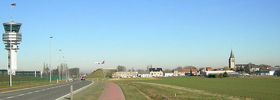
Aircraft
landing at 22R (The tower and the church are midway between runways
22R and 22L.)
teenokkerzeel,
a municipality in Vlaams-Brabant (Flemish Brabant, Belgium) has historically
four centres:
• Steenokkerzeel village, • Ter
Ham,
• Wambeek and
• Hummelgem.
In the 1970s, Steenokkerzeel further absorbed the municipalities of
• Melsbroek and
• Perk.
The western part of Steenokkerzeel and the southern part of Melsbroek
have been turned into an airport zone. Actually, Brussels Airport had its main
building originally in Melsbroek, north of the airport, but left it
to the military
and constructed the passenger building west of there in Zaventem. The cargo
airport is situated in Machelen, northwest of there. The control tower is in Steenokkerzeel.
All these municipalities are in Vlaanderen (Flanders), not in the Brussels
Capital Area.
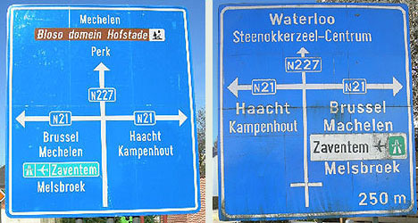
Main roads (national roads) crossing Steenokkerzeel from north to south:
• N227 from Mechelen via Tervuren to Waterloo and
• N21 linking
Haacht in the east with the Brussels North railway station
area in the west.
Directions
to the north and to the south
In 1840, N227 replaced the old “Waalsche baan.” It is very popular as an escape
route during rush hours for the eastern part of the Brussels Ring Motorway
and E19 to Antwerp. For a few years now the section through the centre
of Steenokkerzeel is being relieved by N227b along the fence of the airport.
Brussels
is called Brussel in Dutch, Bruxelles in French, Brussele in Walloon, and Brüssel in German. (Dutch, French and German are Belgium’s official languages, allocated to specific regions.) The name of the city is
derived from Old Dutch Bruocsella, meaning something like “Marshland Place.” English seems to have borrowed the name Brussels not from Dutch but from French.
The N21 (Haachtse steenweg) is an upgrade of the former “Oude Brusselsche Baen,”
originally the “Keulsche Baen.” In the
beginning of the 19th century, traffic from Brussels to the east was diverted
to N2 which leads to Leuven, a few miles south of the N21, and since the 1970s to
the E40 motorway to Liege, a few hundred
metres farther south.
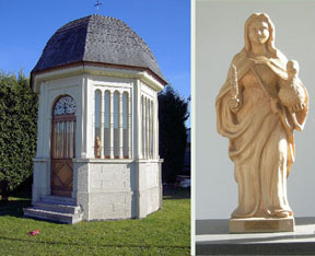
Wambeek is at the intersection of N21 and N227. It was created
as an official municipality by the French in the third year of their revolution,
but it was absorbed by Steenokkerzeel in the eighth year (1799). Wambeek
was a place of veneration of the Saint Pharaildis (Sint
Veerle maagd in more
modern Dutch), daughter of “Theodoricus
Witgerus, een machtigh Prince van Loreynen.” She is represented with a bustard (trapgans in Dutch) under her
arm.
The miracle of the bustard as told by Rosweydus (in 17th-century Dutch):
The
Chapel of Sint Veerle in Wambeek
En onder andere wordt daer verhaelt, hoe dat sy nu out synde, in den
winter op haren acker met terwe besaeyt eene groote kudde trapganzen gevonden
heeft,
de welcke sy als tamme ghedierten met haren stock t'huyswaert gedreven ende
in eenen stal opgesloten heeft, niet toelatende datmen eenigen van die dooden
soude.
Maer soo (ter wijle sy ter kercke was ghegaen) jemandt daar eene af gedoodt
ende met syne medghesellen ghegeten hadde, ende als sy des andere daeghs
willende die voghels vry laten wech gaen, gewaer wierdt dat daer eenen gebrach,
heeft
van een kindt verstaen wat daer af gedaen was.
Siet een wonder werck: sy heeft de beenderen ende pluymen die daer af te
vinden waren, doen vergaderen, ende den voorseyden voghel is gheheel ende
levende
gheworden ende sy heeft dien met de andere na syne ghewoonlijcke weyden laten
gaen.
(The long and short
of this is that Saint Pharaildis
revived
an
eaten bustard from its remnants.)
Together with Nederokkerzeel (now part of Kampenhout), Steenokkerzeel originally
made up a larger area then called Ochinsala.
It was bestowed by Pepin of Herstal together with “Ham” to the Abbey of
Sint Truiden in the 8th century.
• 1076 Hocensele • 1147 Hockenzela
Etymology:
• sala: Franconian for “place” • ochin: different explanations in litterature:
· diminutive
of Hukkon, Hugo (Carnoy)
· hokko, an abbreviation of Hueger, Hugbald (De Vries) • steen: most probably referring
to a stronghold or fortress.
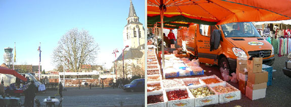
The
airport
tower and the church compete for dominance of the Steenokkerzeel
Sunday market.
International specialties include Moroccan food.
Both the church tower and the airport control tower are midway between
the
final approach to the two east-west runways.
Namegiving of runways is standardized: it is the degrees in the direction one
flies divided by 10. If there are parallel runways, R stands for Right and
L stands for Left.
All runways have double numbering, depending of the direction of use.
Brussels has: 25R = 07L, 25L = 07R and 20 = 02
(there are 180 degrees difference between 250 and 70 and between 200 and 20)
Since in this region winds tend to blow from the west, the 25L is mostly used
for landing of passenger aircraft, while the 25R is mostly used for take-offs
of all aircraft and for landings of cargo and military aircraft (since the
cargo and military airports are at the north).
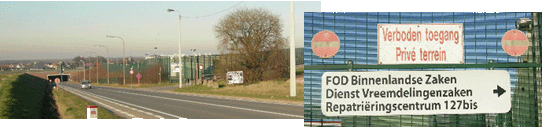
N227 passes under runway 25L-07R just South of Steenokkerzeel. The
centre for illegal immigrants at that corner of the airport attracts protesters
and frequently causes Steenokkerzeel to be mentioned in the news.
Berg (now part of Kampenhout) just east of Steenokkerzeel made the news because of a
major airplane crash in 1961. Casualties included the entire US Figure
Skating team.
A
small monument and the flags of the USA, Belgium and Kampenhout
mark the spot
of the
aircraft crash in Berg (Kampenhout) at the
very
edge of Steenokkerzeel.
The plaque
reads, “A
Sabena Boeing 707 crashed here on February 15, 1961.
We remember the
73 victims.”
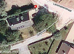
The
exact crash site location according to eyewitness reports
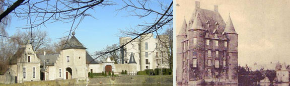
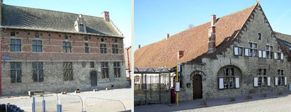
The roof of Ham Castle was completely removed during World War II to
guarantee
safe landing when descending from the east:
The Castle of Ham deprived of its original roof, and what it used to look like.
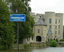
As to the streetnames around the castle, one of the inhabitans was the empress
Zita of Austria I’m not sure I have found all relevant plates referring to inhabitants.
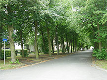
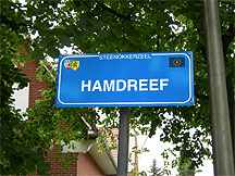
The main road to the castle is Hamdreef.
WNT gives: DREEF (I), znw. vr Mnl. dreve. Van Drijven.
1) Breede weg, geschikt om er vee langs te drijven; breede landweg …
In Belgian French (also in Northern France): drève
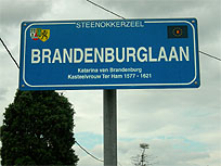
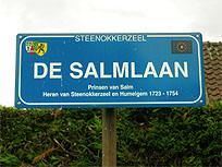
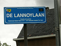
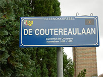
Other roads around refer to former inhabitants or owners of the castle,
including Empress Zita of Austria, Catherine of Brandenburg,
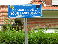
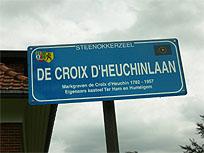
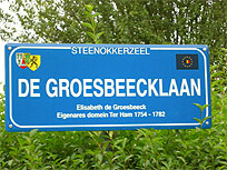
the Princes of Salm, Charles de Lannoy, Guilielmus de Coutereau, Jeanne de
Maillé de la Tour Landry, Margrave de Croix d’Heuchin, and Elisabeth de Groesbeeck.
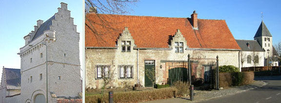
Typical for traditional local buildings is the use of brick and natural stone,
often combined, as in the following examples.
Perk
Hummelgem
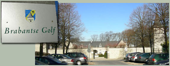
For recreation, Melsbroek offers golf facilities in a very pleasant setting.
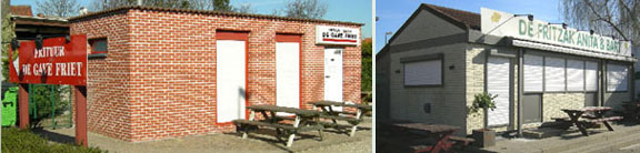
There is a wide variety of decent local eateries, starting obviously
with the fritkot,
offering Belgian fries with a variety of sauces and snacks.
“De gave friet” and “De Fritzak”, both on the old N227
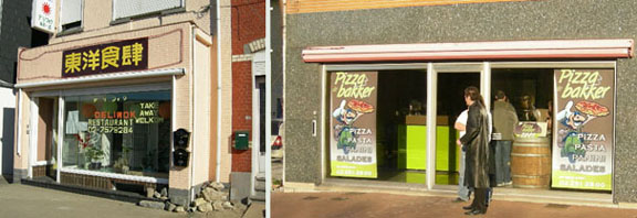
International cuisine is offered as well.
Japanese
and Italian take-away restaurants, both on the old N227
But why not combine a beer with good snacks at the Market Place?
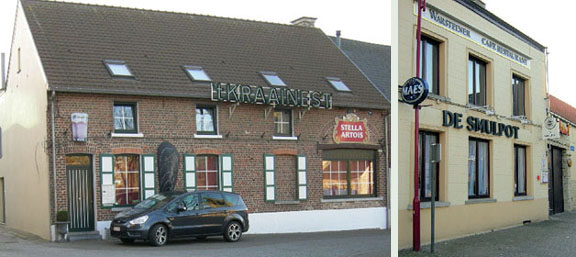
“’t
Kraainest” and “De Smulpot” at Market Place
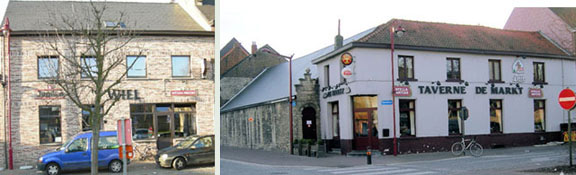
“’t
Wiel” and “Taverne De Markt” at the Market Place
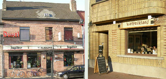
“’t Kliekske” and “kaffeiklasj” (Brabantish for “bar-chat”) at the Market Place
Living in the Flemish “Green Belt” that surrounds Brussels, the people of Steenokkerzeel try to preserve local culture and language,
which are threatened by French-speaking expansion from Brussels. “Dutch for
non-Dutch speakers” courses are
offered locally
on a regular
basis.
Roger Thijs
2008-02-17
All photographs are by Roger Thijs,
with the exception of a part of an old
postcard.

 Contents

 Aircraft
landing at 22R (The tower and the church are midway between runways
22R and 22L.)
Aircraft
landing at 22R (The tower and the church are midway between runways
22R and 22L.) teenokkerzeel,
a municipality in Vlaams-Brabant (Flemish Brabant, Belgium) has historically
four centres:
teenokkerzeel,
a municipality in Vlaams-Brabant (Flemish Brabant, Belgium) has historically
four centres: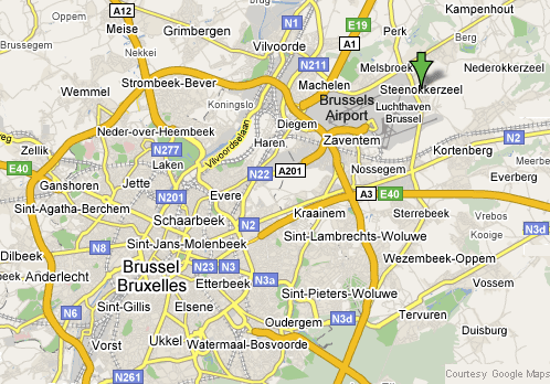
 Brussels
is called Brussel in Dutch, Bruxelles in French, Brussele in Walloon, and Brüssel in German. (Dutch, French and German are Belgium’s official languages, allocated to specific regions.) The name of the city is
derived from Old Dutch Bruocsella, meaning something like “Marshland Place.” English seems to have borrowed the name Brussels not from Dutch but from French.
Brussels
is called Brussel in Dutch, Bruxelles in French, Brussele in Walloon, and Brüssel in German. (Dutch, French and German are Belgium’s official languages, allocated to specific regions.) The name of the city is
derived from Old Dutch Bruocsella, meaning something like “Marshland Place.” English seems to have borrowed the name Brussels not from Dutch but from French.